The wind industry can be approached in many ways and one approach is to divide the branch into wind power technology providers (wind turbines, transformers, power converters, etc.) and wind energy companies developing and owning wind farms. A wind farm planning process takes several years and usually, the wind farm project is managed with dedicated software. The Danish WindPro software by EMD has been a market leader for decades, but also DNV Ltd provides a wind farm design software called WindFarmer. Anyhow, WindPro can be considered to be an industry standard when planning a wind farm and WindPro consists of one basic module and 23 additional modules dealing e.g. with energy calculations, siting, environmental aspects, and project planning (see Figure 1).
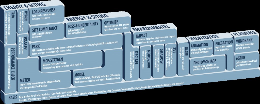
Regarding wind resource assessment in WindPro key modules are Meteo, MCP/Statgen (long-time reference data for the 1-2 years long wind measurement), and the Model – module which functions as the interface to the separate wind assessment software (EMD 2023). The wind assessment software can be either a linear model (WaSP) or a Computational Fluid Dynamics (CFD) model and this software is not included in WindPro.
CFD modeling originates from the oil refinery industry when the flow of liquids and gases in the pipeline needed to be studied more profoundly. Nowadays CFD- modeling is widely used in different kinds of industries like engine and battery manufacturing, the car industry, or Electric motor design (see. Ansys 2023). This article discusses the wind assessment challenges and when it can be a good idea to switch from a linear wind analysis model to a more accurate CFD- modeling.
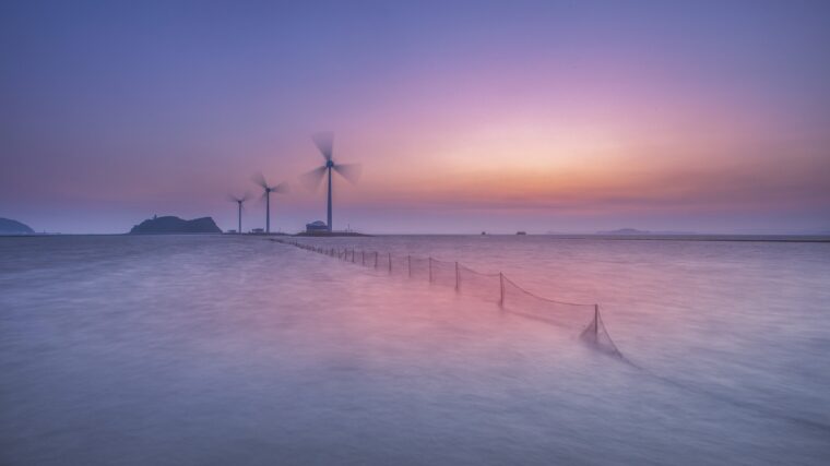
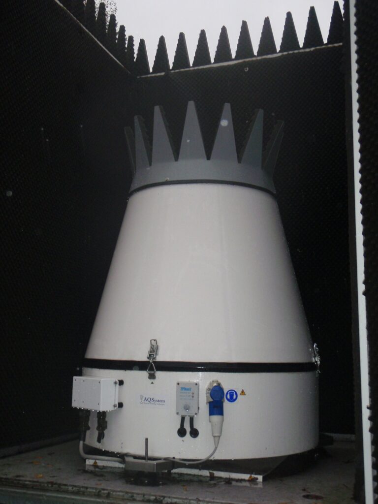
Simultaneously with the permitting process of the wind farm, the wind measurement is conducted on the site with anemometers attached to the met mast. Also, Light Detection and Ranging (Lidar) wind measurement equipment is getting all the time more popular due to the reduced price level and improved technology. The third method to study the wind circumstances on the site is to use a sonic detection and ranging (Sodar) device (figure 2.), but this method has some limitations (e.g., the lost data during a heavy snowfall). There are many sources of errors and uncertainties with the wind measurement, but good wind data is extremely important both for the project developer/owner and the turbine manufacturer. A common proverb regarding wind analysis within the industry is: “When you put crap in you also get crap out from the system.” The next challenge after the high-quality wind measurement is how to analyze the wind data.
Wind data analysis; tricky situations with a linear wind model
The rugged terrain causes uncertainties in wind resource assessment models due to their capability to describe the flow of moving air masses adequately and correctly. This dilemma is often solved by using Computational Fluid Dynamics (CFD) models instead of linear models like WAsP, which can cope poorly with the flow separation that different obstacles cause. Usually, we understand as rugged and complex terrain sites with hills and mountains, but some other factors can increase the ruggedness of the site and make the wind resource assessment extremely challenging. In the literature the Ruggedness Index (RIX) is defined as the fractional extent of the surrounding terrain which is steeper than the critical slope (see. Mortensen & Petersen 1997:1). Rugged conditions can also occur in flat terrain where large objects make a major impact to the airflow. Such circumstances are very common e.g., in the archipelago of Finland where the wind from the open sea faces islands with trees that can have a height of 40 meters. The same phenomena can also occur inland when there is an island of trees in the middle of a huge field.
WAsP as a linear flow model has some restrictions and both the reference point (mast/sodar or lidar measurement) and predicted location of wind turbines are supposed to be within the operating envelope of the WAsP. Both the reference/measurement point and the wind turbine position in a wind farm are supposed to be under the same weather regime and be neutrally stable to their nature (Bowen & Mortensen 2004: 36-37). If we compare coastal sites with inland locations, it is not just a question of sea breezes, because the challenges with the shoreline are much more complicated. The temperature difference between air and sea water masses can get especially high both during the spring and autumn causing great atmospheric instability and variation with the boundary layer height.
In mountainous terrain the shortcomings of WAsP can be adjusted with ruggedness index (RIX) and Mortensen, Bowen& Antoniou (2006) were able to decrease the estimation error significantly. In their study, the standard WAsP calculation overestimated the annual production of the wind farm by 13 percent, and by using the RIX correction the overestimation of the energy production was only about 3 %.
Conclusion
Many projects are studied with linear wind assessment software, but there can be many reasons to use a more expensive and more precise CFD -method. CFD-wind modeling requires more time, better computational capacity, and more working hours. But despite these facts CFD- modeling can offer many benefits also in flat and less complex terrain. The old rule that you need to use CFD modeling only in mountainous terrain with a high degree of atmospheric complexity and instability can be ignored. In the Nordic context especially the temperature difference of water masses of the sea and lakes compared to the air temperature, create such an uncertainty to the wind assessment that the CFD modeling can be highly recommended.
